SOUTH-CENTRAL, Ind. - The National Weather Service (NWS) in Indianapolis says that south-central Indiana will see an increasing chance for showers and thunderstorms this weekend. The biggest concern is from late Thursday night into Friday, when widespread, heavier rainfall may lead to flooding.
A total of 1 to 3 inches is possible for Bartholomew, Johnson, Jackson, Jennings, Shelby, Decatur, and Brown Counties, with locally higher amounts in some areas. Flash flooding may occur if heavier rainfall rates develop.
According to NWS, south-central Indiana is under a "Marginal Risk" (Level 1 of 4)for excessive rainfall on Thursday and a "Slight Risk" (Level 2 of 4) for excessive rainfall from late Thursday into Friday.
Hotter weather is predicted for Sunday, with the high around 90. Temperatures in the low to mid-90s are possible Monday through Wednesday of next week. Heat index values are expected to be in the 100-105 degree range, creating potentially dangerous conditions for individuals spending extended time outdoors.
EDINBURGH, Ind. - The Bartholomew County Sheriff's Office (BCSO) closed the southbound lanes of US 31 at W. County Road 900N at 5:30 a.m. on Saturday, September 26, because of a structure fire.
GREENWOOD, Ind. – Amazon plans to invest more than $100 million to establish a new advanced manufacturing operation in Greenwood, bringing 300 high-paying jobs and a significant new investment to Johnson County.
GREENFIELD, Ind. - An Indiana State Police investigation has led to the arrest of 33-year-old Hancock County Sheriff’s Deputy James Heneghan on charges of intimidation, official misconduct, and fraud.



 New City of Greenwood payment portal begins with October billing cycle
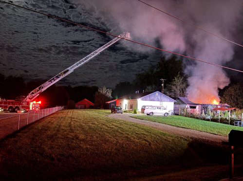 Saturday morning fire halts traffic on US 31 at CR 900N
 Amazon announces $100M advanced manufacturing investment in Greenwood
 Hancock County deputy arrested for intimidation after illegally using license plate cameras
 JCCF 'Community Needs Grant Cycle' applications are available Oct. 5